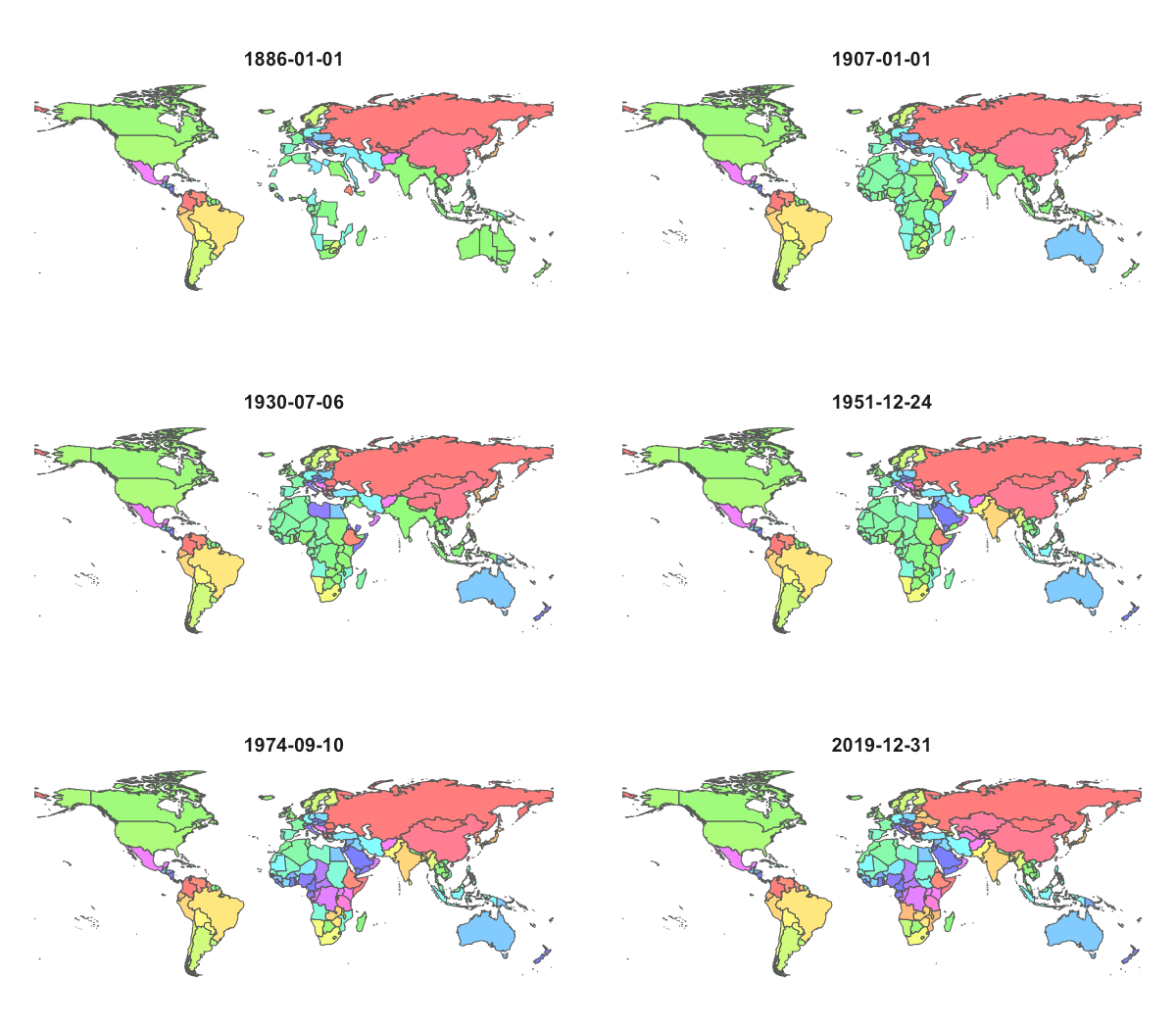
CShapes (beta)
 CShapes 2.1 maps the borders and capitals of independent states and dependent territories from 1886 to 2023. There are two versions of the dataset, which are based on the Gleditsch and Ward (1999) or the Correlates of War coding of independent states. Border changes were coded based on the Territorial Change Dataset by Tir et al (1998), the Encyclopedia of International Boundaries by Biger (1995) and the Encyclopedia of African Boundaries by Brownlie (1979). The dataset can be downloaded in various formats and is also accessible through the CShapes R package.
The current version of CShapes can easily be digested through the CShapes interactive visualizer or through the research-ready country-year format provided by the GROWup Research Front-End data portal.
The CShapes R package gives convenient access to the data from the R statistical environment. Install the cshapes package using R's package manager, or alternatively, type
> install.packages("cshapes", dependencies = TRUE)
on the R console. This will also install other R extensions required by cshapes. Alternatively, you can install the local copy of the package through:
> install.packages("cshapes_2.1.tar.gz", repos=NULL, type="source", dependencies = TRUE)
You may also download the latest version (2.1) of the raw CShapes data directly in CSV (UTF-8 encoded), GeoJSON, Shapefile, SQL, and R package formats:
| Codebook | CSV | Tab-delimited | GeoJSON | Shapefile | SQL | R | |
|---|---|---|---|---|---|---|---|
| CShapes 2.1 | |||||||
| CShapes 2.1 - Correlates of War (COW) compatible edition |
For the user's convenience, we provide precomputed dyadic country distance data based on CShapes. While all the distances can be computed in a much more flexible way with our cshapes R package, the precomputed datasets should be sufficient for most applications. Note: the dyadic distances in the file are computed annually, for January 1st of the respective year.
Citation
When using this dataset in your research, please cite the following publication:
Previous versions
See the change log for the current version number and a list of revisions.
| Codebook | CSV | Tab-delimited | GeoJSON | Shapefile | SQL | R | |
|---|---|---|---|---|---|---|---|
| CShapes 2.0 |
When referring to the previous 0.x.x versions please cite:
License

CShapes by Schvitz, Rüegger, Girardin, Cederman, Weidmann, Gleditsch is licensed under a Creative Commons Attribution-NonCommercial-ShareAlike 4.0 International License.
This research has benefited from generous financial support from the Swiss National Science Foundation (Grant 100017_156339). This project has received funding from the European Research Council (ERC) under the European Union’s Horizon 2020 research and innovation programme (ERC Advanced Grant agreement No.787478 NASTAC).